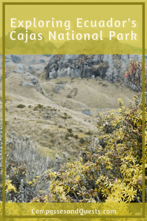
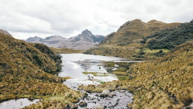
Clouds hung low over the mountains above Cuenca, clinging to the lush vegetation and damp rocks. Our bus wound up the road en route to Guayaquil, but we were prepared to hop off at the entrance to Cajas National Park. Cajas, a UNESCO Biosphere Reserve, covers thousands of hectares of the rugged and beautiful Ecuadorian continental divide. In the park, you can find over 200 lakes and numerous species of plants and animals. Cajas National Park is an incredible place to explore nature and makes for a great excursion from Cuenca.
Preparing for a Day in Cajas National Park
The altitude and climate in Cajas National Park make hiking here no joke, so it is important to come prepared. A few hikers have died in the park after being lost and stuck there overnight, but adequate preparation can ensure a safe and fun adventure.
Most of the park lies between 3,000 and 4,000 meters (9,800 and 13,100 feet) in elevation, so many travelers choose to take a day or two to acclimate in Cuenca. Drink plenty of water and get sufficient rest before venturing to the park. Bring some snacks and water on your hike as well.
The weather in Cajas is unpredictable and changes quickly. At such a high altitude, the temperatures can drop below freezing. It can also be fairly warm, especially when sunny, so wearing layers is a good idea. The air and ground in the park can be very damp, so bring a rain jacket, a hat/hood to keep your head dry and warm, and waterproof boots or shoes you don’t mind getting muddy. If you plan to camp overnight in the park, bring a quality tent and sleeping bag and extra warm layers.
The park is large and there are many trails that can be taken, some of which are not well marked. Before starting the hike, have a good idea of what trail you want to do or ask the officials at the refugio for a map and advice on which trail to take. We recommend leaving in the early morning to have plenty of time to hike.
Getting To the Park
There are many tour operators that take groups from Cuenca to Cajas National Park for single day or overnight tours. If you go with a tour, your transportation to and from the park should be included. If you want to save some money or would rather experience the park without a group, it is easy to reach the park by your own means. You can rent a car from Cuenca and park at the refugio, or you can take a bus.
You can catch a bus heading to Guayaquil from Cuenca’s main Terminal Terrestre, asking to get off at Laguna Toreadora or wherever you plan to start your hike. The cost should be only a couple USD. We were planning on taking the Occidental bus company, but their office didn’t open until 8:00 a.m. Luckily, we found some other companies at the main Terminal Terrestre that have buses going to Guayaquil a bit earlier. There is a food court at the terminal for a quick breakfast if you want to grab food before your bus.
We hopped off at the refugio at Laguna Toreadora. Here, we were asked to sign in and show our passports. Entrance is to the park is free. Ask for a map before beginning your hike if desired. The refugio allows for overnight stays, but there are limited spots. There is also a restaurant here if you want to stop for a bite after your hike.

Hiking in Cajas National Park
If you aren’t on a tour, it is completely up to you which trail you take. There are various trail lengths and difficulties, ranging from a couple hours to multiple days. A great hike for an easier day or if you have limited time is to do the trail around Laguna Toreadora. For a multi-day excursion, try the Inca Trail or the trail to Soldados.
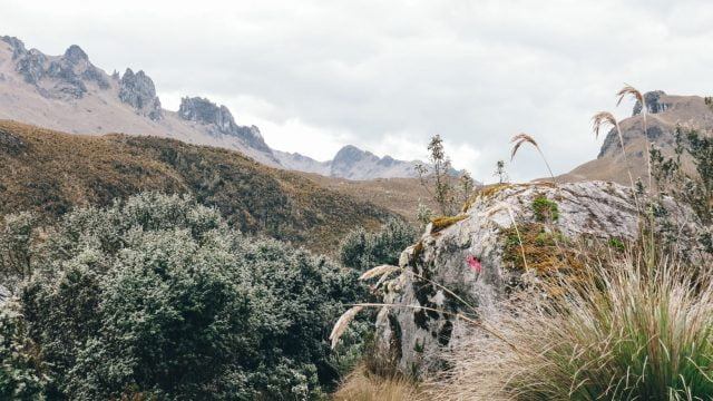
There are many day hikes, such as the climb to Cerro San Luis or the García Moreno trail. We combined multiple trails, which allowed us to see various lakes and sights along the way. For more information on trails, visit the park website. Park officials marked many of the trails with spray paint every so often. The colors used correspond to the color of the trail on the maps they offer at the refugio.
Our adventure started at the refugio and wound around to the far side of Laguna Toreadora. It was cloudy and damp, so the air was brisk and the trail muddy. There were thousands of yellow and white flowers lining the trail.
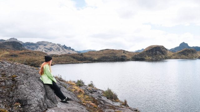
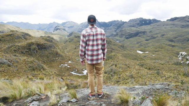
We passed a few overlooks, and the views of the rugged mountains and numerous lakes were stunning. Other than the slippery mud, the trail was fairly easy and mostly downhill. Seemingly out of nowhere, we entered a quinua forest. It was like an eerie scene from a fairytale. Fog lingered in the upper branches as we wandered through the dense trees. Moss covered the damp ground, and the orange limbs of the trees stretched upward in odd shapes. It was such a unique and beautiful landscape!
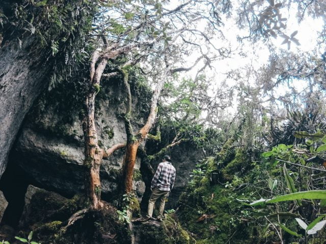
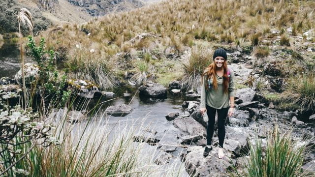
The trail left the forest, and we continued to descend towards Laguna Totoras after passing Laguna Unidas. What looked to be the normal, muddy trail turned out to be a giant sinkhole, and Lia sank in up to her knees. We were both somewhat muddy at that point, so we took a break to wash off our shoes and pants in the creek.
The trail ascended a bit to drier land, and we became somewhat confused on our direction near Laguna Totoras when the path seemed to disappear. We saw two trails in the distance in opposite directions. So, we guessed and made our way to the trail that went around the right (south) side of Laguna Totoras.
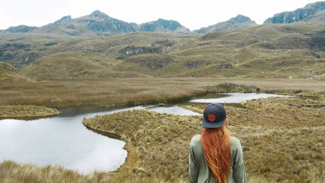
We soon reached Laguna Patoquinuas. We also came across some rocks with a red spray paint marking, confirming that we were at least on a trail.
The views by Laguna Patoquinuas were incredible, so we saw this as a great time to stop and take in the scenery with lunch. There was nobody else in sight! After relaxing for a bit, we continued past the lake, intending to reach the road to catch a bus back to town.
Back to Cuenca
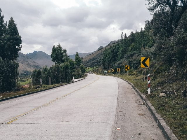
We followed the trail along some pine trees and came out onto the same road our bus drove up earlier that day. We walked down the road a ways, making our way to a toll station where the bus would stop to pick us up.
If you see a bus passing and are not at the toll station, some will still stop if you wave them down. Avoid asking them to stop on curves, as this can be dangerous to you and other traffic on the road. The cost should be around $2 again. You can either get off back at the terminal in Cuenca or you can hop off earlier if it is more convenient.
Final Words on Visiting Cajas National Park
Cajas National Park is a must see if you find yourself in Cuenca. The variety of trails make it a great place for travelers of all hiking levels, and the landscape is truly unique. We loved the chance to escape the city for a day and wished we had more time to explore the park.
For more fun things to do in Cuenca, check out our post!
Like this Post? Pin it!