
White Tank Mountain Regional Park is a pretty place to enjoy some desert scenery only a short ways from Phoenix. So many people raved about the Waterfall Trail in the park, so we thought we’d give it a try. While we will admit that this was nowhere near our favorite hike in Arizona, the park is still a lovely place to enjoy the outdoors.
The White Tank Mountains have more to offer beyond this trail, so consider pairing this hike with a drive through the park, a picnic, or another hike. If you are looking for a short and easy trail that’s also great for kids, the Waterfall Trail is a good option!

Getting to the Waterfall Trail Trailhead
White Tank Mountain Regional Park sits a ways off Highway 303. After getting off the highway and going left on W Northern Avenue, we took a right on N Cotton Lane, then a left on W Olive Av staying on that road until it entered the park and turned into White Tank Mountain Rd.
The cost to get into White Tank Mountain Regional Park is $7 per car for a day. It is only a couple bucks if you walk or cycle into the park. Make sure you display your pass on your dashboard. To get to the trailhead, you’ll continue on the paved White Tank Mountain Rd for a ways, eventually turning left on N Waterfall Canyon Rd. The parking lot is off to the left. Even though it was early on a Monday, the lot was already almost full.

White Tank Mountain Waterfall Trail Overview
Hike Distance: 1.8 miles (2.9 kilometers) round trip
Hike Duration: 45 min – 1.5 hours
Trail Type: Easy out and back
Cost: $7 per car
Regulations: Dogs must be on a leash. No camping at the trailhead. Please stay on the trail and don’t touch the petroglyphs!
What to Bring: Water, hat/sunscreen for lack of shade on the trail, comfortable shoes, camera, card or cash for entry fee.
Hiking the Waterfall Trail
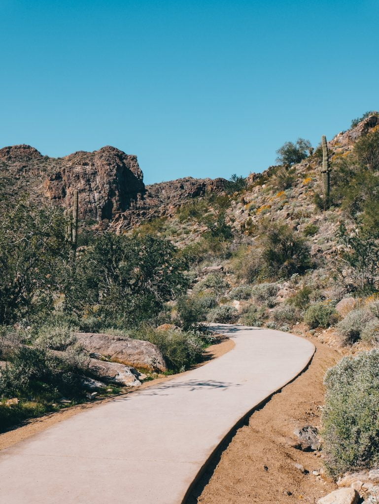
From the parking lot leads a wide, paved, and well-maintained trail. There were people of all ages out enjoying the desert. Dogs are allowed as well, just keep them leashed. As we hiked up the slightly inclined trail, a view of the valley emerged behind us. The views along the hike were nothing spectacular, though it did get prettier as we hiked further into the canyon.
We visited White Tank Mountain Regional Park with the intention of seeing the amazing desert bloom that occurs in Arizona every spring. We were not disappointed! Purple, white, yellow, and red flowers dotted the desert around the trail. Also keep an eye on the large boulders around the trail to see the petroglyphs that cover them.

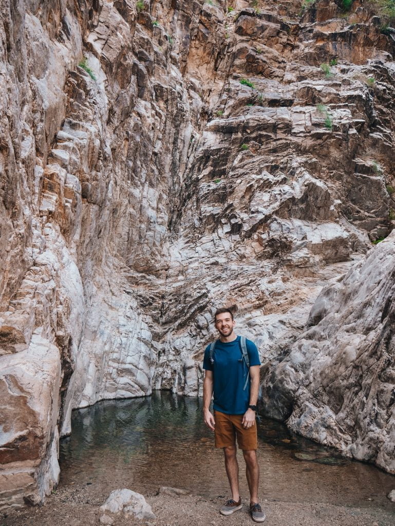
The trail turns to dirt about half way up, but it is still wide and well-maintained. After just under a mile, we made it to the falls. The canyon narrows at the top and you have to do a little river crossing to make the last step up to where the canyon dead ends at the waterfall. Since the water level was so low, we didn’t get wet at all. We have heard that the water can get above the knee after a big rain.
There was a somewhat long line of people making their way up this little step and taking turns snapping photos at the base of the falls. We waited our turn and then walked up the sandy wash to a little pond at the base of the falls. We weren’t expecting the falls to be flowing because it is dry more often than not. There was a slight trickle. If you want a good flow, go during monsoon season after a hard storm.
Since it was pretty crowded at the base of the falls, we didn’t stay long and headed back down the trail the way we came.
Exploring More of White Tank Mountain Regional Park
White Tank Mountain Regional Park is the largest regional park in Maricopa County with around 30,000 acres of rugged desert landscape. There are quite a few trails of varying lengths here. We wanted to explore more of the park because we weren’t overly thrilled with the Waterfall Trail and we wanted to spend more time there to see the spring bloom. From the Waterfall Trail trailhead, we continued down N Waterfall Canyon road.

There were pull-offs where artists were painting and people were picnicking at the many tables in the park. We stopped at a few of these spots to take in the desert scenery. This road loops back to White Tank Mountain Rd. We stopped at another trailhead on this road to hike the Black Rock Loop. The desert was glowing with yellow flowers that contrasted starkly against the dark rock. This trail was much quieter than the Waterfall Trail, which allowed us to enjoy the scenery a bit more.
Like this Post? Pin it!
