Taxi drivers jangled their keys and badges in front of our faces, tour company representatives pushed wrinkled brochures into our hands, and all of the passengers shoved past each other to grab their bags from the undercarriage of the bus. It felt way too early for all of this after a long overnight bus from Lima. We grabbed our bags and wandered outside the bus terminal quickly to get away from the crowd.
Maybe we forgot to breathe or maybe it was the thin air, but our hearts were pounding as we stopped to catch our breaths and figure out where our hostel was located. The hike up the hill with all of our bags confirmed for us that it would be a good idea to acclimate a bit before going on any long hikes. So, we set our minds on heading to Laguna Wilcacocha. It was the perfect way to acclimate after being at sea level for the past few months.
Getting to Laguna Wilcacocha
After dropping the bags off at the hostel, we headed into the center of Huaraz and waited for a combi. Either bus 10 or E would get us to Chiwipampa (the town on Rio Santa below Laguna Wilcacocha) for only about a sol per person. Most of the combis pass through Antonio Raymondi street in Huaraz, three blocks north of the Plaza de Armas. We waved down a van and hopped in. In about 30 minutes, we reached our stop and jumped out on the side of the road.

Hiking Up to the Lake
Hike Overview
Hike Type: Moderate out-and-back trail
Distance: 4 miles (6.4 kilometers) round trip
Duration: 3-4 hours
Regulations: Stay on the roads and paths to avoid wandering through somebody’s property
The trailhead isn’t marked, but we knew the general direction of the hike, so we crossed a large bridge and began our ascent. The sun was out, making it fairly warm as we walked up the steep dirt road. About 10 minutes into the hike, a small, rocky trail veered off the road on the left. We had no clue where we were going, but we took the trail. We aren’t sure if we went the right way the whole time, as we ended up on some random roads and near small houses. If there are some locals out and about they will kindly point you in the right direction if you’re unsure.
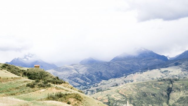
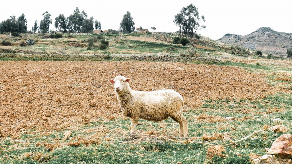
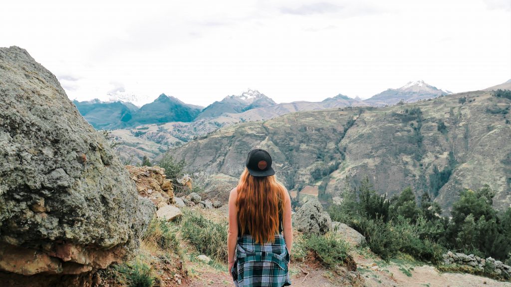
The hike to Laguna Wilcacocha was definitely a unique one. Instead of being immersed in nature, the entire hike goes straight up through an agricultural village. Farmers work with their horses and ox on their plots of land, and children, roosters, sheep, donkeys, and cows break the silence. The peaceful village sits on the steep hill overlooking the snowcapped peaks of Cordillera Negra and Blanca in the distance.
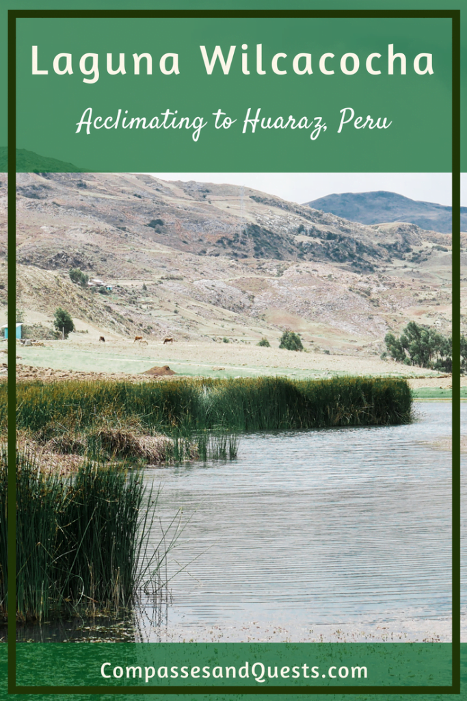
Laguna Wilcacocha
We were visiting Huaraz in the middle of December during the rainy season, so heavy clouds covered the Cordilleras for much of the hike. Despite the dark clouds looming over us, a few locals also strolled up to Laguna Wilcacocha to enjoy some food and the views. Breathing hard, we made it up to the lake in about 1.5 hours.
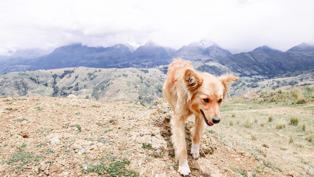
Laguna Wilcacocha turned out to be more of a pond. Several quiet homes sat on the hillsides surrounding the lake, and colorful birds went about their business on the water as a llama grazed along the shore. The sight of the cordilleras was the most impressive view. We made our way to the other side of the lake and settled on a rocky perch. A few stray dogs sat patiently at our sides as we ate some pastries we picked up earlier at the local market.
Threatening clouds rolled over the lake and a few large raindrops plopped around us. We decided this would be a good time to head down the hill. We hurried down the rocky path as thunder rumbled above us. By the time we made it back towards the first steep hill above the main road, the rain had begun to fall heavily. We pulled our hoods up and rushed across the road to hitch a ride heading back to Huaraz. A man picked us and another individual up, dropping us in the center of town. We gave him a few soles.
Our Thoughts on Laguna Wilcacocha
While it wasn’t the most beautiful hike in the Huaraz area, the Laguna Wilcacocha hike was good to do to acclimate to the altitude and prepare for longer treks. The altitude here was no joke after being at sea level for months.
This hike is commonly noted as a good test to determine whether you are fit to go on the higher, longer, and harder hikes that are popular in the cordilleras. Some tour guides say that the general benchmark to gauge how well adapted you are to the altitude is taking two hours to reach the lake from the bottom. Don’t forget to stop to take plenty of water breaks along the way!
This hike was also a great option because it is easy to get to without a tour, making it budget friendly. It is not far from Huaraz and doesn’t take a long time to complete, making it ideal for a half-day activity. The village around Wilcacocha was very peaceful, and we enjoyed seeing people go about their daily lives and experiencing a bit of the countryside.
Like this Post? Pin it!