
The large amount of stellar hiking options in Sedona can be overwhelming if it’s your first visit or if you have limited time. While Fay Canyon isn’t one of the most popular or iconic hikes in the area, it offers some classic Sedona views and isn’t too long or strenuous. We particularly enjoyed Fay Canyon for its partially shaded trail (a game-changer in the Arizona heat) and the climb to a beautiful view at the end.

Getting To Fay Canyon
Fay Canyon Trailhead lies down Boynton Pass Road. From Highway 89A, go north on Dry Creek Road. Keep left where Dry Creek Road turns into Boynton Pass Road. Make two more lefts when the road comes to a T, staying on Boynton Pass Road the whole way. The trailhead parking sits on the left side of the road and is well-marked. There is ample parking at the trailhead and there are restrooms.
Matt’s parents and siblings came into Phoenix, and we drove up to Sedona for Labor Day Weekend. We arrived early and were surprised to find that it really wasn’t too crowded. The trail through the canyon begins right across the road from the parking lot.

Fees
Unlike many Sedona hikes, this trail does not require a Red Rock Pass or state park fee. Fay Canyon lies in Coconino National Forest.
Fay Canyon Hike
Fay Canyon Trail leads along the base of towering orange cliffs through large desert shrubs that provide some welcomed shade.
There is an arch that sits off the right side of the trail just under a mile in. We have heard mixed reviews about the arch, but cannot testify as we didn’t know it existed when we were there. Seeing as that it is a very short ways off the trail, it might be worth checking out! We have read that the path is narrow and rocky, so use caution if you decide to visit it. For a hike to another awesome Sedona arch, take a look at our post on Soldier’s Pass!

After about 1.2 miles (2 kilometers), we made it to a river bed and sign reading ‘End of Trail.’ However, you don’t want to stop here if you want the real reward! The hike up until this point was pretty flat. Continue past the sign up the rocky hillside for the best views of the hike. The trail is fairly obvious. Though this portion of the path is steep, it’s well worth the view overlooking the canyon.
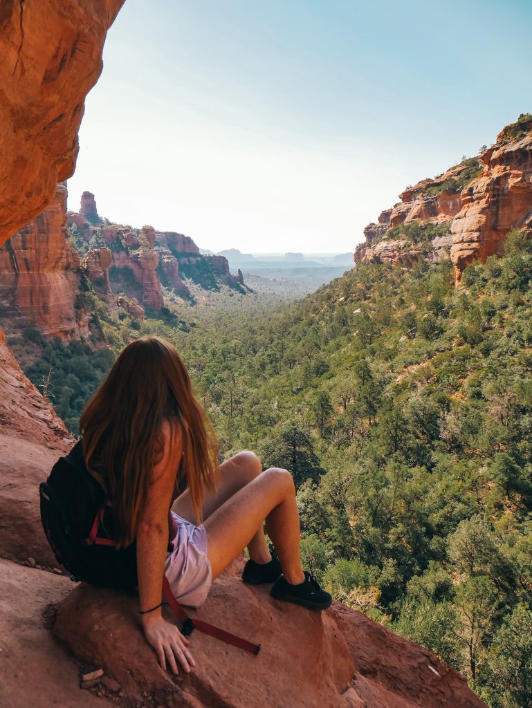
We explored the cliffs a bit, taking in the views. As this isn’t a maintained part of the trail, use caution and your best judgement when scrambling about. As more and more people began to make their way up the trail, we decided to head back down to avoid the crowds and hottest part of the day.
Fay Canyon Overview
Hike Type: Easy out-and-back trail
Hike Distance: About 2.4 miles (3.9 kilometers)
Duration: 1.5-2 hours if you stop at the arch and hike to the top
Cost: Free
Regulations: Dogs are allowed on leash
What to Bring: Sturdy shoes, plenty of water, camera, bug spray, sunscreen and hat
Like this Post? Pin it!
