
Idaho has quite the unique variety of landscapes, including expansive lava fields formed by volcanic flows thousands of years ago. Today, these areas are covered by dark, jagged rock and are home to a surprising abundance of plant and wildlife despite the harsh environment. Visiting Hell’s Half Acre is a great and convenient way to explore some of Idaho’s lava fields if you’re in the Idaho Falls area or traveling down the I-15 corridor.
About Hell’s Half Acre
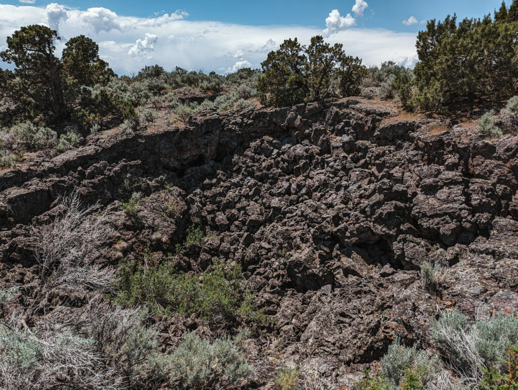
Despite its name, Hell’s Half Acre is actually a lava flow that stretched over 162,000 acres. Scientists estimate that the eruption occurred around 4,100 years ago, releasing lava that flowed at over 2,000°F and traveled at speeds of up to 30mph!
Today, what remains are lava caves and tubes, jagged fragmentations, wrinkly pahoehoe formations. Sage brush and other vegetation have begun to grow wherever they can root, and marmots, coyotes, rabbits, hawks, rattlesnakes and other creatures thrive here despite the rough terrain.
A portion Hell’s Half Acre was designated as a National Natural Landmark by the Park Service in 1976. A portion of it also forms a Wilderness Study Area.

Getting to Hell’s Half Acre
Hell’s Half Acre sits just west of Idaho Falls and has two main access points.
The most common way to reach it is via I-15 to the Blackfoot Rest Areas. There are trails that lead from both the northbound and southbound rest areas. These are a very convenient stop as they are right off the highway. Here, there are restrooms, informational signs about the area, ample parking, and picnic tables spread out near the parking area and along the trails.
Alternatively, if you’re looking for a longer hike or to escape the busy rest stops and highway sounds, you can head to the access point further north. From Idaho Falls, head west on West Arco Highway (20) and turn left down a short dirt road to reach the trailhead parking area. There is a sign along the highway indicating the Lava Trail turnoff, but there are a couple forks once you turn on the dirt road, so we’d recommend taking a look at Google Maps beforehand.

Fees & Regulations
Much of Hell’s Half Acre is BLM-managed. There are no fees to recreate here or use the rest stop facilities.
Please stay on the trails. Trails may close during the winter months due to icy conditions. There are signs at the northbound Blackfoot Rest Area trails indicating that dogs are not permitted on the hiking paths.

Exploring Hell’s Half Acre
Hell’s Half Acre contains three official hiking areas that allow visitors to explore and enjoy this unique landscape.
While we think Hell’s Half Acre isn’t quite as impressive as the lava fields at Craters of the Moon, this is a great quick stop near Idaho Falls.
The Lava Trail
We haven’t made it up to the northern side of Hell’s Half Acre Wilderness Area to hike the Lava Trail. But we will add any details to this post as soon as we do!
The area consists of a mile-long loop and an 11-mile (roundtrip) trail that leads a ways into the heart of the wilderness area. The trails up here are primitive and not well-marked. A little navigational skill and extra caution as you make your way across the rugged landscape may be needed, especially for the longer option.

The Blackfoot Rest Area Trails
The two trail systems near I-15 were along our route between Utah and our home in Montana.
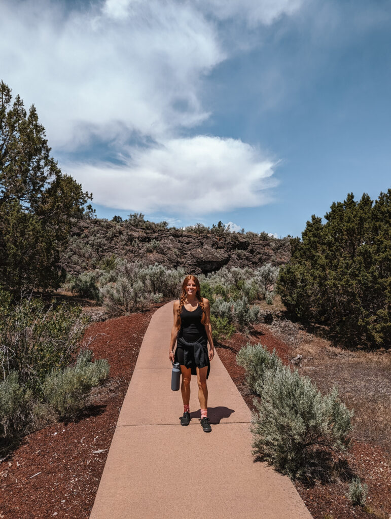
Both of these spots are incredibly convenient because they are close to the highway and you can stop for just a quick look over the lava field from atop the rest stop building or take more time to read the signs, eat at the picnic tables, and stretch your legs while enjoying the short trails. The signs near the parking area and along the trails provide interesting facts on the formations and wildlife here.
Northbound
The northbound Blackfoot Rest Area offers three loops – the Lower Loop (0.4 miles), the Short Loop (0.3 miles), and the Long Loop that extends off the Short Loop (0.5 miles). The trails are paved with some grated bridges. The Lower Loop is wheelchair accessible.
Southbound
The southbound Blackfoot Rest Area offers two loops – the Lower Loop (0.25 miles) and the Upper Loop (0.5 miles). The trails are paved with some grated bridges. The Lower Loop is wheelchair accessible.

What to Bring
Water: It can get quite hot out on the trails.
Sun Protection: There is little shade along the trails, except under the manmade structures. So bring sunglasses, sunscreen, and/or a hat.
Snacks/Picnic: There are many benches along the trail and some picnic tables near the rest stop to enjoy a snack or packed meal outdoors.
Comfortable Shoes: The trail isn’t too strenuous and the rest stop trails are paved. If you hike the trails to the north, you’ll want sturdy shoes that provide solid tread and protection from the jagged rock, cacti, etc.
Camera: If you’d like to capture some of this unique landscape.
Like this Post? Pin it!
